Surkhandarya region
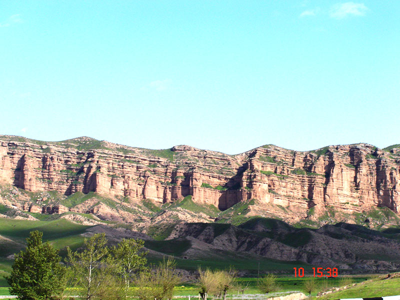
Surkhandarya is the south part of the Republic. It shares borders with Tajikistan, Turkmenistan and Afghanistan. Surkhandarya region was founded on March 6, 1941. The central and southern part of the area is flat. Located in the north of Hissar Range, to the west and north-west, in its spurs - Baysuntau mountain (4425 m) and Kugitangtau (3,139 m), located in the East Ridge Babatag (up to 2290 m), in the south - the valley of the Amu Darya River.
Climate - the dry desert in the south to the north of the subtropical (Mr. Uzun). The average January temperature is +3 °, in July +30 ° C. On the plains, rainfall ranges from 130 mm to 360 mm per year, in the foothills - from 440 mm to 620 mm
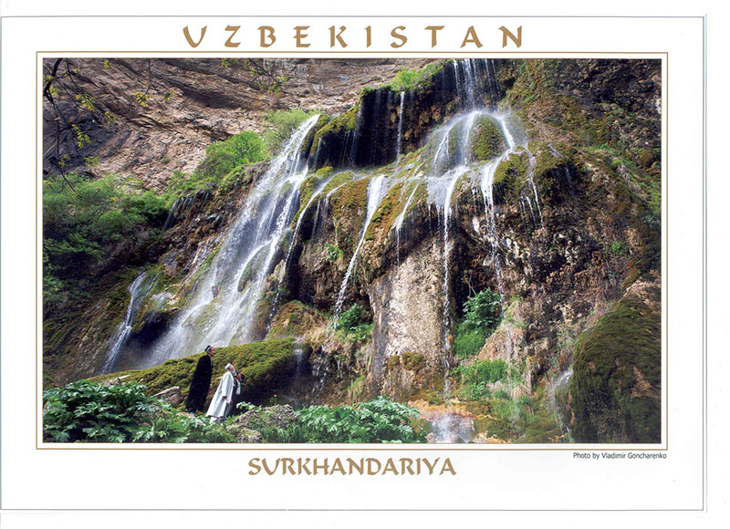
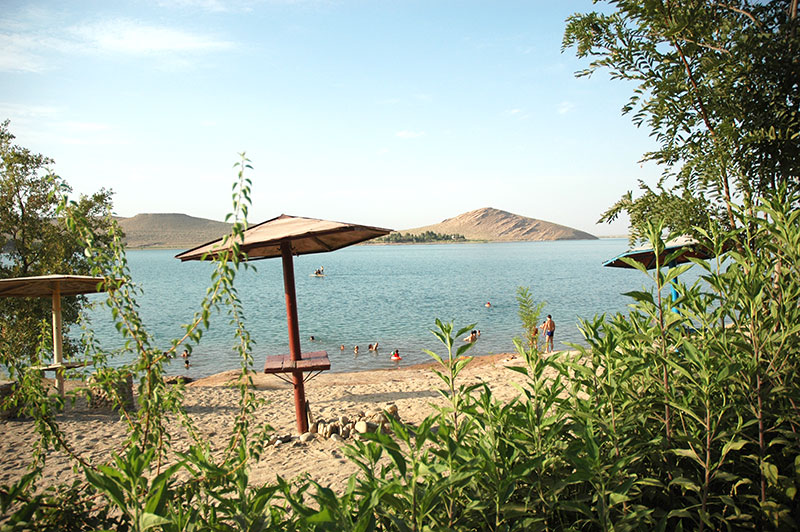
Nature. The central and southern part of the region - a plain, bordered to the north Hissar range (southern slope, to a height of 4,643 m), on the west and northwest its spurs - Baysuntau mountains (up to 4425 m) and Kugitangtau (up to 3139 m), in the east - the backbone Babatai (up to 2290 m) in the south - the valley of the Amu Darya. Climate plains with a warm winters and hot, dry and long summer. The average January temperature is 2,8-3,6 ° C, July 28-32 ° C. Annual precipitation in the plain from 130 to 360 mm per year, in the foothills and mountains, from 445 to 625 mm. For southern Surkhandarya typical winds and south-westerly wind (Afghan). Frost-free period from 226 to 266 days. High summer temperatures, frost-free period, provided irrigation, induce the maturation of thermophilic here subtropical crops (long staple cotton, Oriental persimmon, etc.) and even sugar cane. The main rivers - tributaries Surkhandarya and Sherabad flowing down from the surrounding mountains. The rivers are fed by snow and glaciers and snow-rain power, to make full use of their irrigation water reservoir built: South Surkhan (800 million m3), Uchkyzylskoe, Degresskoe; Sherabad channels, Amu Zangsky, Jarkurgan waterworks, canals reconstructed Zhang , Hazarbag, Kumkurgan.
The soils on the plain - light and typical gray soils, river floodplains - meadow and meadow-swamp, in the foothills and mountains - typical and dark gray soils, turf-burozemnye and light brown. The vegetation in the plains dominated ephemera. In the mountains, the vegetation is ephemeral-grass, in the highlands - subalp, fescue-motley, there are trees and shrubs - juniper, wild fruit, mountains Babatag thickets pistachios. In the valley of the Amu Darya - Tugan. In the mountains there are gazelle, ibex, wild boar, lynx, wolf, jackal, fox, bear, porcupine, of birds - pheasant, partridge, skylarks. In rivers - barbel, carp, carp, chub. In 1964 created the Aral-Paygambarsky reserve to protect the Bukhara deer (hongul), snakes (ffs, asp, etc.). There are reserves of oil, gas, coal, salt, gypsum, and other minerals.
Population According to the 2010 population of the region has about 000 people in 1910. [3] The main population of Uzbeks 1,566,000 people (82% of total population). And also, in a number of other nationalities, including Tajiks, Russian, Tatars, Koreans, Afghans, and others.
Economy The economy of the region is agriculture. Fine-fiber cotton varieties are grown. There are 26 large industrial enterprises. The leading industries in Surkhandarya region are light and food industries. Less importance is the mining industry: about Haudaga, Uchkyzyla, Lyalmikara Kokaido and existing oil and gas fields.